
קובץ:The Prairies-map.jpg
אין גרסה ברזולוציה גבוהה יותר.
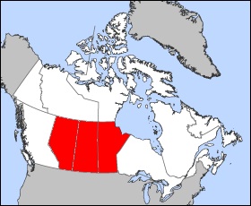
The_Prairies-map.jpg (280 × 230 פיקסלים, גודל הקובץ: 27 ק"ב, סוג MIME: image/jpeg)
זהו קובץ שמקורו במיזם ויקישיתוף. תיאורו בדף תיאור הקובץ המקורי (בעברית) מוצג למטה
ויקישיתוף הוא מאגר תמונות וקובצי מדיה חופשיים. אתם יכולים לעזור. |
תקציר
| תיאור |
Map of Alberta Projection: Lambert azimuthal equal-area Geospatial data from: The Atlas of Canada, The National Atlas of the United States and U.S. Geological Survey Cartographer: John Fowler Map of Saskatchewan Projection: Lambert azimuthal equal-area Geospatial data from: The Atlas of Canada, The National Atlas of the United States and U.S. Geological Survey Cartographer: John Fowler |
| תאריך יצירה | (UTC) |
| מקור |
קובץ זה הוא יצירה נגזרת של: |
| יוצר |
|
| זוהי תמונה מרוטשת, זאת אומרת שהתמונה שונתה בצורה דיגיטלית מהמקור. Modifications: combined red selected regions in all maps. את התמונה המקורית ניתן לראות ב: Saskatchewan-map.png. השינוי בוצע על ידי ויקיג'אנקי.
|
רישיון
| ברצוני, בעלי זכויות היוצרים על יצירה זו, לשחרר יצירה זו לנחלת הכלל. זה תקף בכל העולם. יש מדינות שבהן הדבר אינו אפשרי על פי חוק, אם כך: אני מעניק לכל אחד את הזכות להשתמש בעבודה זו לכל מטרה שהיא, ללא תנאים כלשהם, אלא אם כן תנאים כאלה נדרשים על פי חוק. |
יומן העלאה מקורי
This image is a derivative work of the following images:
- File:Alberta-map.png licensed with PD-self
- 2005-03-24T12:10:41Z Voyager 280x230 (14865 Bytes) Map of Alberta Projection: Lambert azimuthal equal-area Geospatial data from: [http://atlas.gc.ca/ The Atlas of Canada], [http://www.nationalatlas.gov/ The National Atlas of the United States] and [http://www.usgs.gov U.S.
- File:Manitoba-map.png licensed with PD-self
- 2005-03-24T12:12:50Z Voyager 280x230 (14829 Bytes) Map of Manitoba Projection: Lambert azimuthal equal-area Geospatial data from: [http://atlas.gc.ca/ The Atlas of Canada], [http://www.nationalatlas.gov/ The National Atlas of the United States] and [http://www.usgs.gov U.S.
- File:Saskatchewan-map.png licensed with PD-self
- 2005-03-24T12:18:27Z Voyager 280x230 (14852 Bytes) Map of Saskatchewan Projection: Lambert azimuthal equal-area Geospatial data from: [http://atlas.gc.ca/ The Atlas of Canada], [http://www.nationalatlas.gov/ The National Atlas of the United States] and [http://www.usgs.gov
היסטוריית הקובץ
ניתן ללחוץ על תאריך/שעה כדי לראות את הקובץ כפי שנראה באותו זמן.
| תאריך/שעה | תמונה ממוזערת | ממדים | משתמש | הערה | |
|---|---|---|---|---|---|
| נוכחית | 04:29, 25 באפריל 2014 | | 230 × 280 (27 ק"ב) | ויקיג'אנקי | User created page with UploadWizard |
שימוש בקובץ
הדף הבא משתמש בקובץ הזה:
שימוש גלובלי בקובץ
אתרי הוויקי השונים הבאים משתמשים בקובץ זה:
- שימוש באתר he.wikipedia.org