
קובץ:London heathrow 01.JPG
לקובץ המקורי (3,648 × 2,736 פיקסלים, גודל הקובץ: 8.57 מ"ב, סוג MIME: image/jpeg)
זהו קובץ שמקורו במיזם ויקישיתוף. תיאורו בדף תיאור הקובץ המקורי (בעברית) מוצג למטה
ויקישיתוף הוא מאגר תמונות וקובצי מדיה חופשיים. אתם יכולים לעזור. |
תקציר
| תיאור |
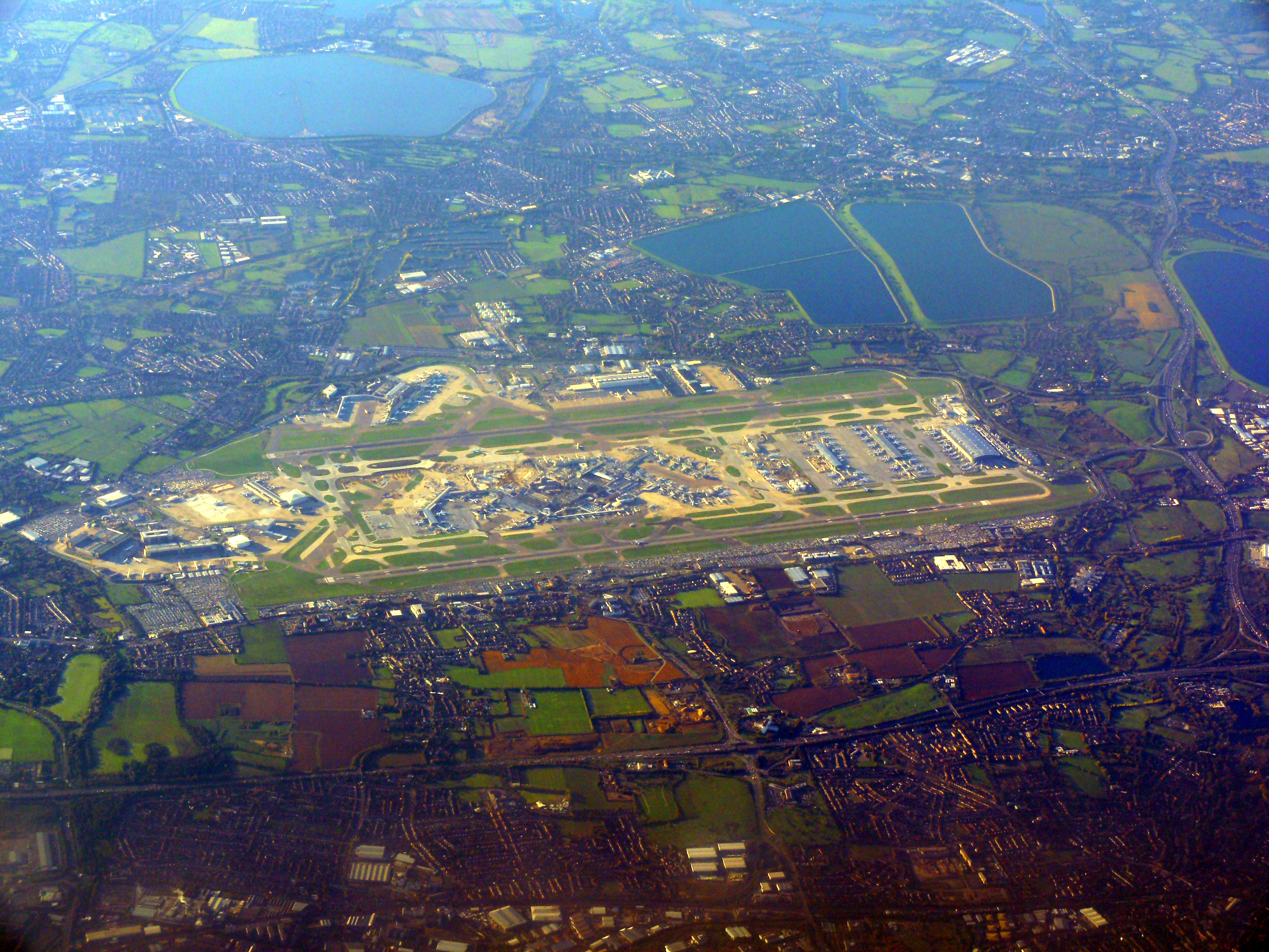
English: London Heathrow Airport or Heathrow, at the far south of the London Borough of Hillingdon, is the largest airport in the United Kingdom. It is close to two relatively busy sections of motorway (M4 and M25) shown and the surrounding land, as can be traced in many parks, sports fields, green buffer heaths, lakes and a few residual farms (and great reservoirs built on woodland and grazing land, east and west, respectively), was mainly rural in use until the 1960s; it widely has a gravel extraction use leading to most of the smaller lakes. The nascent towns of Staines and Ashford fully shown are linked by railway to London.
Nederlands: Londen Heathrow de grootste luchthaven van het Verenigd Koninkrijk. |
|||
| תאריך יצירה | ||||
| מקור | נוצר על־ידי מעלה היצירה | |||
| יוצר | Ad Meskens | |||
| אישורים והיתרים (שימוש חוזר בקובץ זה) |
You are free to use this picture for any purpose as long as you credit its author, Ad Meskens. Example: © Ad Meskens / Wikimedia Commons
This file has been released under a license which is incompatible with Facebook's licensing terms. It is not permitted to upload this file to Facebook.
|
|||
| גרסאות אחרות |


.JPG)
| מיקום המצלמה | | תמונה זו ותמונות נוספות במיקום: OpenStreetMap |
|---|
רישיון

|
מוענקת בכך הרשות להעתיק, להפיץ או לשנות את המסמך הזה, לפי תנאי הרישיון לשימוש חופשי במסמכים של גנו, גרסה 1.2 או כל גרסה מאוחרת יותר שתפורסם על־ידי המוסד לתוכנה חופשית; ללא פרקים קבועים, ללא טקסט עטיפה קדמית וללא טקסט עטיפה אחורית. עותק של הרישיון כלול בפרק שכותרתו הרישיון לשימוש חופשי במסמכים של גנו. |
- הנכם רשאים:
- לשתף – להעתיק, להפיץ ולהעביר את העבודה
- לערבב בין עבודות – להתאים את העבודה
- תחת התנאים הבאים:
- ייחוס – יש לתת ייחוס הולם, לתת קישור לרישיון, ולציין אם נעשו שינויים. אפשר לעשות את זה בכל צורה סבירה, אבל לא בשום צורה שמשתמע ממנה שמעניק הרישיון תומך בך או בשימוש שלך.
- שיתוף זהה – אם תיצרו רמיקס, תשנו, או תבנו על החומר, חובה עליכם להפיץ את התרומות שלך לפי תנאי רישיון זהה או תואם למקור.
| Annotations | This image is annotated: View the annotations at Commons |
היסטוריית הקובץ
ניתן ללחוץ על תאריך/שעה כדי לראות את הקובץ כפי שנראה באותו זמן.
| תאריך/שעה | תמונה ממוזערת | ממדים | משתמש | הערה | |
|---|---|---|---|---|---|
| נוכחית | 21:26, 2 בנובמבר 2010 | | 2,736 × 3,648 (8.57 מ"ב) | Ad Meskens | {{Information |Description={{en|1=London Heathrow Airport or Heathrow, in the London Borough of Hillingdon, is the largest airport in the United Kingdom.}} {{nl|1=Londen Heathrow de groots |
שימוש בקובץ
הדף הבא משתמש בקובץ הזה:
שימוש גלובלי בקובץ
אתרי הוויקי השונים הבאים משתמשים בקובץ זה:
- שימוש באתר af.wikipedia.org
- שימוש באתר he.wikipedia.org